How blue-green infrastructure can be designed and monitored in a climate-friendly way was the topic of the Anthropocene Forum.
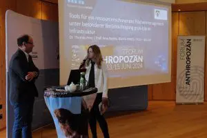
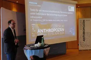
The international forum on the anthropocene is an important platform when it comes to sustainable strategies in a world shaped by humans. This year, the forum dedicated itself to the topic of water. iSPACE studio manager and PLUS employee Thomas Prinz traveled to Heiligenblut and presented “Tools for resource-conserving land management with a special focus on green-blue infrastructure”.
The topic of water was probably on the minds of all participants, as the event was accompanied by news of heavy rainfall and increasing heat stress. These extreme weather events are becoming more and more likely due to the climate crisis.
Adaptation to climate change has therefore become the buzzword of the moment. It is essential for municipalities in land management. This is because it preserves the protective functions of green-blue infrastructure. For example, using existing resources in building land instead of sealing off areas and greening. In these projects, a data-based approach guarantees the empirical evaluation of the situation and helps to identify measures. Studio manager Thomas Prinz presented key results from the Alpine Building Center project, for example. Spatial development and climate change adaptation must be thought off as one, even if this raises questions about priotrities.
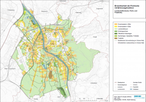
Measurements based on GIS-date
In several research projects, Studio iSPACE and its partners are investigating questions about efficient housing structures, infrastructures, owner mobilization and more. The BONANZA project has already entered its third round after its predecessors BONSEI! and BONUS were met with great success. It advises property owners on how to create redensification in the city of Salzburg.
For these data-supported projects, Studio iSPACE analyzes GIS data, i.e. data from geoinformation systems. This includes the building stock, environmental green and open spaces, mobility axes and other markers. With the help of these quantitative evaluations, PLUS and Studio iSPACE can make qualitative recommendations. The promotion of biodiversity, climate change adaptation and the recreation and health of residents should be at the top of the municipalities’ list of priorities.
Climate fitness is measurable, geoinformatics enables the calculation of its spatial indicators for municipal master planning and communication. Data thus creates reproducible calculation methods that provide a basis for long-term monitoring. This ensures a high degree of transferability and spatial comparability at different levels, from the district to the region, and makes qualitative follow-up possible.
In Salzburg, an analysis of the recreational quality of urban green spaces showed what is possible through data evaluation. Among other things, GIS-based questions about the accessibility of green spaces and water areas were addressed. In this way, a map can be created for Salzburg that shows the green and blue network and can be filtered according to various aspects.