Over a period of six years, 24 project partners created first a HEAT atlas and then an ENERGY atlas, which is already being used in three Austrian federal states.
Spatial energy planning is one of the most important instruments for sustainable climate change adaptation. The Spatial Energy Planning for Energy Transition (GEL S/E/P II) project aimed to improve the planning basis and builds on the previous Spatial Energy Planning for Heat Transition (GEL S/E/P I) project. The focus was on administrative processes and in the heat sector. In GEL S/E/P II, the project was expanded to include mobility and, in part, electricity. The basic principles in the heating sector were further developed and deepened and the target audience was expanded from users from the administrations to include energy companies.
The project worked with users in workshops to identify and define specific use cases, such as energy topics in local development concepts, building submissions, municipal heat planning, reports and monitoring. Based on this, harmonised methods were developed to provide a basis for spatial energy planning. Partners from science, energy agencies, energy infrastructure operators and the federal provinces of Salzburg, Styria and Vienna worked together on the project and contributed a wide range of perspectives.
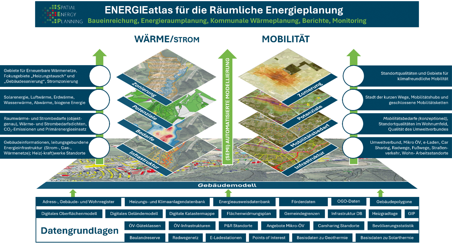
The most important project results are the comprehensive digital ENERGY atlas prototype and the automated reporting functions based on it. The ENERGY atlas contains detailed information on buildings, energy and mobility requirements, renewable energy potential and infrastructure. Largely based on a comprehensive building model, planning-relevant information – for example on the building stock, heating systems, degree of refurbishment and energy requirements, mobility requirements and infrastructure – is presented. For example, the energy inventory analysis for the spatial development concept is designed as a report that can be generated automatically. This prototype was further developed outside of the research project. By the end of 2024, more than two thirds of the municipalities in the province of Salzburg have already requested and received such a report. The energy inventory analysis goes into detail, maps and interprets the energy system of a municipality.
GEL S/E/P I with HEATatlas as the cornerstone
The GEL S/E/P I preliminary project laid the foundation for the implementation of spatial energy planning in the heating sector by developing the basic methods, processes, IT and data exchange requirements. A HEAT atlas for visualising location-specific, energy-related information – heating requirements, energy supply infrastructure and renewable energy potential – was developed for the heating sector.
During the course of the project, a clearly structured method for the development of information bases for spatial energy planning was developed, with standardised templates for all necessary steps.
Another key result of the GEL S/E/P I project was the development of a building model that provides building properties such as use, dimensions and heat demand and enables the visualisation of these building properties on digital maps.
The work was then continued and deepened in the GEL S/E/P II project. The WÄRMEatlas was also expanded to include the electricity and mobility sectors and a comprehensive heatatlas was developed.
Possible roll-out for other federal states
The ENERGY Atlas provides the public administration with information bases that enable a wide range of applications, including in the areas of communication, analysis and planning, decision support and reporting obligations as well as monitoring. In order to promote these applications, a ‘hub’ was set up in each participating federal state as part of the project in the form of a committee with representatives from the city and state administration. The project results were regularly presented to the hubs and the development of the ENERGY Atlas was adapted to the requirements of the hubs in each participating federal state. In addition, efforts were also made to scale up the ENERGY Atlas in Bregenz and Villach through various dissemination activities.

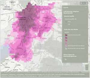
Integrierte Analyse. Grafik: Projektkonsortium
The added value of the S/E/P method lies, for example, in the focus on applications, in the bottom-up approach, in the high spatial resolution and generally in the high-quality data basis as well as the aim of integration into the GIS systems of the federal states. As the S/E/P method was developed in a harmonised manner across the three federal states of Styria, Vienna and Salzburg, the results are comparable across all federal states. Thanks to the harmonised methods, the ENERGY Atlas has great potential to be rolled out to other federal states.
More on Use Cases
The atlas provides detailed insights into the heating, electricity and mobility sectors. The building model in particular enables precise analyses of energy requirements, heating systems and refurbishment potential, while other layers evaluate renewable heating potential such as solar energy, near-surface geothermal energy and air heat pumps. Automated reporting functions make this data easy to utilise, for example for municipal planning processes.
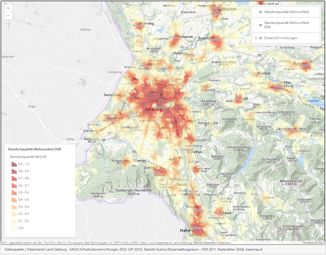
A significant step forward in the project was the extension of the methods to the mobility and electricity sectors. In the mobility sector, for example, location qualities for sustainable forms of transport were assessed and areas required for e-charging stations were identified. In the electricity sector, the focus was on planning photovoltaic areas on sealed sites and analysing electricity demand densities in order to support coordinated infrastructure planning.
The project’s standardised methodology is based on a modular approach that enables the flexible combination and further development of different subject areas. Particular attention was paid to the automatability of data updating and the integration of the results into existing GIS systems. This considerably facilitates the application of the developed methods and creates broad usability for different planning tasks.
Neben den technischen Innovationen hat das Projekt auch rechtliche Herausforderungen adressiert. Ein umfassendes Screening relevanter Rechtsmaterien identifizierte Unsicherheiten, etwa im Datenschutz oder in der Datenbereitstellung. Ergänzend wurden praxisorientierte Leitfäden erstellt, die beispielsweise die Koordination von Infrastrukturprojekten oder die Zonierung von Potenzialgebieten erleichtern.

The ENERGY Atlas was presented at many events, such as the Mission Innovation Austria Week at the end of 2024.
In addition to technical innovations, the project also addressed legal challenges. A comprehensive screening of relevant legal matters identified uncertainties, for example in data protection or data provision. In addition, practice-orientated guidelines were created to facilitate the coordination of infrastructure projects or the zoning of potential areas, for example.
More than 20 partner institutions were involved in this project in three federal states over a period of six years. The requirements of EU directives (in particular the Energy Efficiency Directive – EED III, Renewable Energy Directive – RED III and Energy Performance of Buildings Directive – EPBD) create new tasks for the administration, which can be significantly simplified through structured spatial energy planning and the availability of energy-related data. While the relevant competences such as spatial planning and building law lie primarily at federal state level, the EU requirements affect the federal government. The federal government is now faced with the challenge of promoting a corresponding structure for the federal states and with regard to the fulfilment of its own obligations, which supports the achievement of the targets on the one hand and the documentation of these target contributions on the other.
The S/E/P method can contribute to this. The three participating federal states and Vorarlberg were already actively using the content in 2024. There was articulated interest from energy agencies in four other federal states.


